





Se promener à La Croix-Valmer
La Croix-Valmer associe un bourg discret, des vignes, de grands espaces naturels littoraux, la memoire du Debarquement et une botanique mediterraneenne tres protegee.
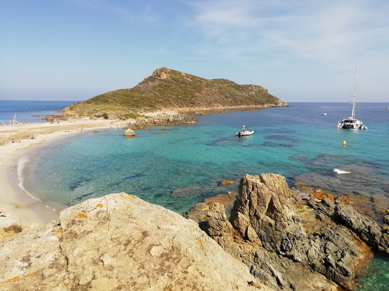
La Croix-Valmer ne ressemble ni à un vieux village compact ni à une station entièrement bâtie autour du front de mer. La commune s'étire entre un centre modeste, des secteurs de vigne, des vallons, puis de grands espaces littoraux qui comptent parmi les plus sensibles du golfe. C'est cette longueur qui donne son rythme à la promenade.
On y marche donc moins pour accumuler des monuments que pour comprendre une relation entre paysages. Le village, les vignobles, Gigaro, les caps et les criques se répondent. La Croix-Valmer se lit en séquences, chacune avec sa lumière, son relief et son rapport à la mer.
Un village de passage entre l'interieur et le rivage
Le cœur du bourg pose les premiers repères: église, commerces, marchés, rues d'usage et départs vers les quartiers plus bas. Mais il ne résume pas la commune. Très vite, la promenade glisse vers les vignes, les routes forestières ou les chemins qui descendent à la plage du Débarquement, à Sylvabelle ou à Gigaro.
Cette organisation explique une part de l'identité locale. La Croix-Valmer a gardé une mesure provençale discrète tout en vivant en lien constant avec le littoral. L'histoire du Débarquement de Provence, encore présente dans certains toponymes et parcours, ajoute une mémoire forte à ce territoire de rivage.
Gigaro, Cap Lardier et Cap Taillat
Les secteurs de Gigaro, de Cap Lardier, de la Briande, des Brouis et de Cap Taillat constituent le cœur naturel de la commune. On y découvre un littoral protégé, des sentiers, des criques, des plages, des pentes boisées et des ouvertures très franches vers la mer. Le fait que La Croix-Valmer soit commune du Parc national de Port-Cros donne la mesure de cette valeur écologique.
Ici, la promenade change de ton. Le village s'efface derrière les chemins, les ganivelles, les roches, les pins et la continuité du sentier littoral. Le paysage devient plus physique et plus lent. C'est souvent là que l'on comprend le mieux la place de La Croix-Valmer dans le grand paysage du golfe.
Geologie du littoral et flore mediterraneenne
Le rivage repose sur des reliefs cristallins qui plongent par endroits brusquement vers la mer. Les caps, les petites anses et les plages sableuses forment un dessin très découpé où la géologie reste visible. Entre ces secteurs, les vignes et les terrains plus souples du plateau changent la texture de la commune.
La botanique est partout: pins parasols, maquis, chênes-lièges, espèces littorales adaptées au sel et au vent, mais aussi herbiers de posidonie sous l'eau. Les vignes croisiennes ajoutent leur propre lecture végétale. À La Croix-Valmer, la flore n'est pas un décor secondaire; elle structure les chemins, les ombres, les odeurs et même la manière de protéger le territoire.
Culture locale, terroir et marche responsable
La culture communale tient beaucoup dans le rapport au terroir. Les domaines viticoles, les marchés, les usages de promenade et les consignes très présentes sur le respect de la forêt, du feu ou des cueillettes montrent un territoire où la fréquentation touristique doit composer avec un milieu fragile.
Cela donne à la commune une tonalité particulière: plus discrète que spectaculaire, plus attachée aux continuités de paysage qu'à l'animation permanente. La Croix-Valmer plaît justement parce qu'elle garde cette part de réserve entre village, culture de la vigne et grands espaces naturels.
Comment la parcourir aujourd'hui
Le plus cohérent est souvent de choisir un secteur par demi-journée: le village et les vignes, ou bien Gigaro et les caps, ou encore la descente vers une plage. Vouloir tout traverser d'un seul coup risque de réduire la visite à la route. En revanche, un parcours bien calibré laisse apparaître les vraies transitions du site.
Hors pleine saison, les contrastes deviennent beaucoup plus nets. Les sentiers sont plus lisibles, la botanique plus perceptible, les points de vue plus calmes et les liens entre patrimoine, géographie et littoral protégé ressortent avec plus d'évidence.
Pour prolonger cette marche, on peut gagner Cavalaire-sur-Mer pour une autre lecture du littoral, ou revenir à la page des villages du golfe.