



Se promener à La Môle
La Mole montre le versant le plus rural du golfe: une vallee d'eau et de pres, des bois, le barrage de la Verne, des pentes des Maures et un village de passage reste a l'annee.
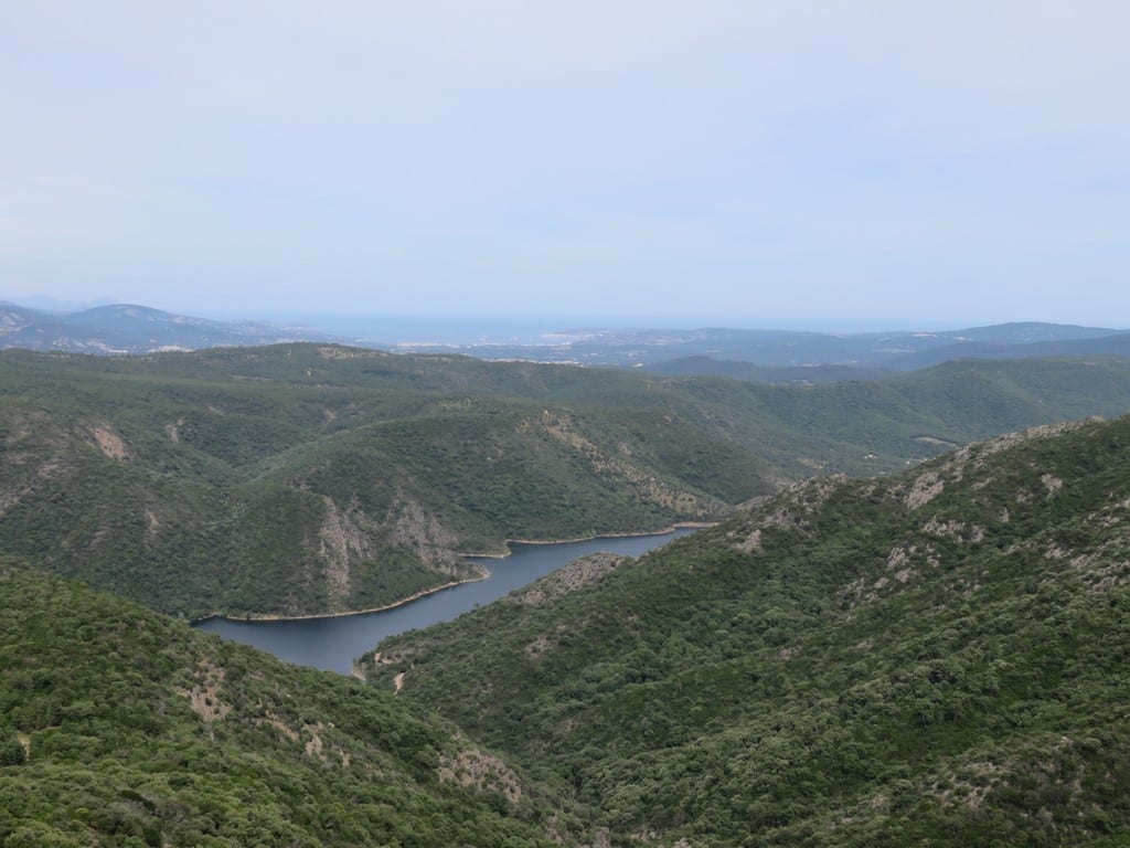
La Môle appartient au golfe par ses routes, mais elle s'en distingue par sa géographie de vallée. Ici, le paysage se lit d'abord par le cours d'eau, les prés, les bois, les reliefs qui ferment l'horizon et les passages vers le col du Canadel ou vers le barrage de la Verne. On est loin des quais, et c'est précisément ce qui fait l'intérêt du lieu.
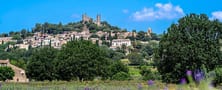
Le village lui-même reste modeste, habité et très lisible. Il ne cherche pas l'effet monumental. Sa valeur tient dans la continuité entre le bourg, l'agriculture, les chemins, les forêts de bord de rivière et les pentes des Maures. La Môle donne ainsi une autre mesure du territoire: plus intérieure, plus lente et plus liée aux cycles naturels.
Une commune de vallee et de passage
La Môle s'organise autour de son fond de vallée. Les routes qui la traversent relient le littoral aux reliefs et à l'arrière-pays. Cette situation de passage compte beaucoup: la commune n'est pas un cul-de-sac, mais un lieu qui articule plusieurs directions du golfe sans prendre la posture d'un centre touristique majeur.
Cette position rend le paysage très mobile. Les vues s'ouvrent sur des prairies, se ferment contre des bois, puis repartent vers les pentes. La commune se comprend donc moins par un grand monument que par une géographie de circulation entre eau, route, forêt et relief.
Patrimoine discret et memoire locale
Le cœur du village garde l'église Sainte-Marie-Madeleine, repère simple mais très présent, et une vie de proximité qui distingue La Môle des communes plus tournées vers la saison. Plus haut, la chapelle Sainte-Magdeleine ouvre un autre rapport au territoire, avec une vue large sur le village et le golfe.
Cette discrétion est une force. À La Môle, le patrimoine n'écrase pas le paysage; il l'accompagne. L'inscription gravée sur la façade de l'église, les rues courtes du bourg, les petits équipements et les traces d'une commune de travail donnent au lieu une tonalité sobre, rurale et durable.
Eau, barrage de la Verne et geologie des Maures
Le barrage de la Verne donne à la commune un repère majeur. Il rappelle l'importance de la ressource en eau dans un territoire méditerranéen sec, mais aussi la façon dont l'ingénierie moderne s'inscrit dans un relief ancien. Les pentes boisées, les vallons et les secteurs humides voisins montrent que l'eau change ici profondément les usages et les paysages.
La géologie du massif des Maures reste très lisible dans ces reliefs fermes, souvent forestiers, appuyés sur des terrains cristallins. Les sols de bord de rivière, plus souples, contrastent avec les pentes plus sèches. Cette opposition entre vallée humide et hauteurs minérales aide à comprendre la répartition des cultures, des bois et des habitats.
Botanique, forets riveraines et paysages agricoles
La Môle tient beaucoup à sa végétation. Forêts riveraines, prairies, chênes-lièges, châtaigniers, maquis et clairières se succèdent selon l'altitude et la présence d'eau. Cette diversité donne à la commune une texture végétale plus riche qu'un simple paysage sec de collines.
L'agriculture et les chemins prolongent cette lecture. Les prés, les cultures, les bords de rivière et les pentes forestières composent une botanique vécue, c'est-à-dire une flore qui accompagne encore l'usage du sol et la vie locale, et pas seulement la contemplation.
Comment l'aborder aujourd'hui
Le plus juste est de prendre d'abord le village à son échelle, puis d'élargir vers la Verne, la chapelle ou un itinéraire de marche. Cette progression permet de sentir comment le bourg reste lié à la vallée et non plaqué sur elle.
Hors saison, la commune gagne en lisibilité. Les prés reprennent leur place, les forêts de bord d'eau se sentent mieux, et le contraste entre patrimoine discret, géologie des Maures et botaniques de vallée apparaît avec plus de netteté.
Depuis La Môle, on peut poursuivre vers Le Rayol-Canadel-sur-Mer en franchissant le col du Canadel, ou rejoindre La Garde-Freinet pour comparer deux lectures de l’arrière-pays.